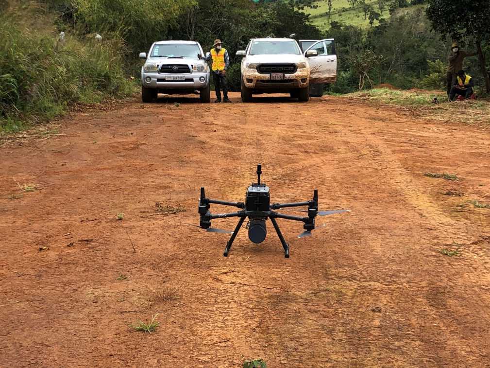
We use drones equipped with survey-grade sensors to acquire information about features and objects without making physical contact. Using LiDAR and cameras we collect and process geospatial data concerning land, structures, vegetation, and more. The data is analyzed and applied to our surveys, studies, mapping, and designs.
JEB is Cambodia’s leading remote sensing provider delivering precise and accurate LiDAR and photogrammetric surveys in all types of terrain. JEB partners with ATGT, one of the biggest French survey firms, to process the data. Our LiDAR surveys provide guaranteed ground points (min 5 pts/m2), even in the densest vegetation.
LiDAR Surveys
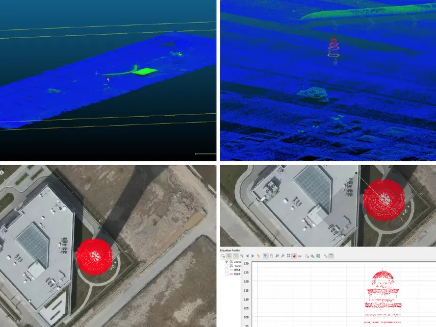
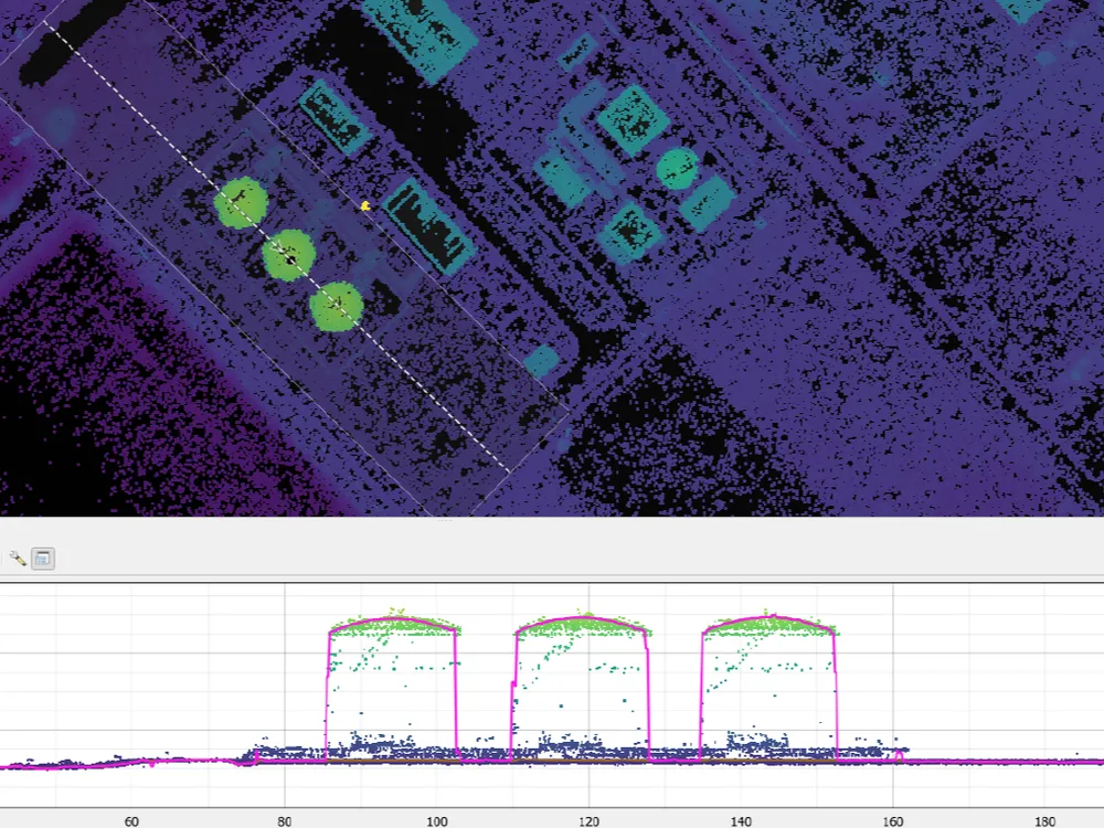
Light detection and ranging (LiDAR) devices measure features by pulsing light beams and calculating the reflection properties of each individual beam. This data produces a high-density point cloud. The LiDAR data generates a point cloud which is combined with differential global positioning system (DGPS) data to obtain highly accurate X, Y, and Z coordinates for each point. Our drone-mounted LiDAR excels in high-accuracy surveying and is capable of penetrating heavy vegetation.
Equipment:
- DJI M300 RTK
- CHC AA9, 500Hz, 300 pts/m2, 7 hectares/min
- Genius 16, 300Hz, 80 pts/m2, 3.5 hectares/min
Deliverables:
- DEM: Digital Elevation Models
- DTM: Digital Terrain Models
- DSM: Digital Surface Models
- Raw and Colorized Point Clouds
- XYZ Files
Photogrammetry Surveys
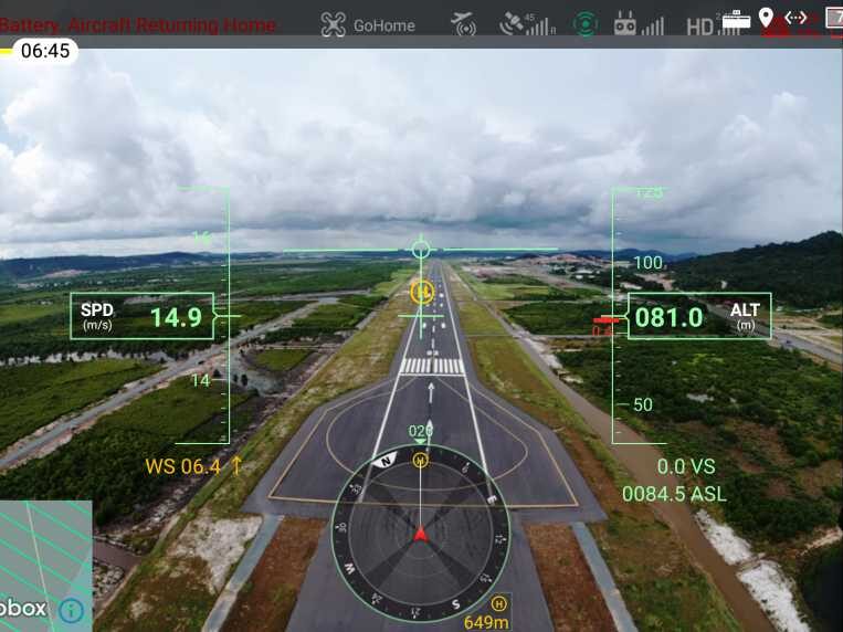
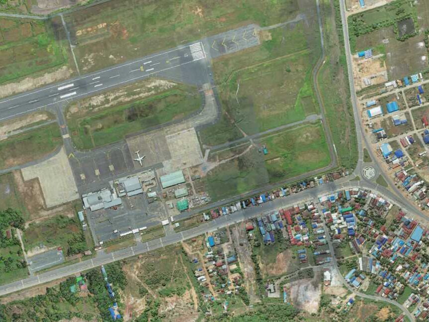
The latest UAV technologies offer practical and cost-efficient ways to produce photogrammetry. UAVs are also used to shoot photography and video enabling a better understanding of a site location. Once processed, the aerial imagery produces georeferenced orthomosaics with accurate geometry, dimensions, and object positioning (with accuracy up to 2cm). Aerial surveys are used to control and monitor site construction, perform volumetric calculations, support topographic surveys, and generate 3D models.
Equipment:
- DJI M300 RTK
- Zenmuse P1 35mm
- DJI Phantom 4
- DJI Mavic Pro 2
- DJI RTK Base Station
- Trimble Software
Deliverables:
- DEM: Digital Elevation Models
- DTM: Digital Terrain Models
- DSM: Digital Surface Models
- Orthomosaics
- 3D Mesh Modeling
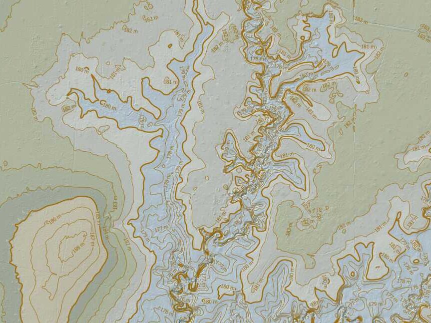
Geographic Information Systems (GIS)
We use Geographic Information Systems (GIS) as a link between our engineering designs and the physical world. CAD is excellent for drawing the precise geometry of infrastructure, GIS provides us with the spatial context, terrain, environmental constraints, and existing infrastructure in the surrounding area.
We perform suitability analyses, advanced hydrological modeling, map constraints, analyze terrain, and aggregate large datasets like LiDAR point clouds, satellite imagery, BIM models, and traditional survey data.
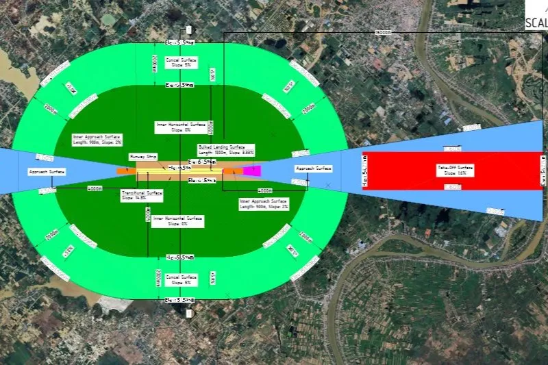
Drone Surveys and Remote Sensing Projects
High-resolution data from a new perspective. We capture accurate aerial imagery, LiDAR data, and 3D models to optimize planning and monitoring.