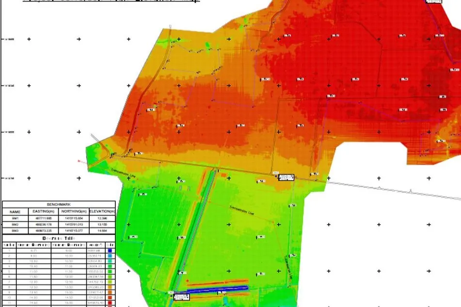
JEB carried out a feasibility study for a potential solar farm development in Kampong Thom, Cambodia. One major concern upon our site reconnaisance was the risk of flooding due to the proximity of a large natural lake serving as a reservoir.
We surveyed the land using LiDAR and Photogrammetry and spot surveyed key areas in the surrounding area to obtain land and water levels. 40 soil tests using CPTu and 20 resistivity surveys to understand the electric conductivity of the ground were also conducted.
This data came together to produce detailed topographic maps of the site, watershed and catchment maps, a flood analysis, as well as recommendations for flood protection, foundations, and site layout.